Topography
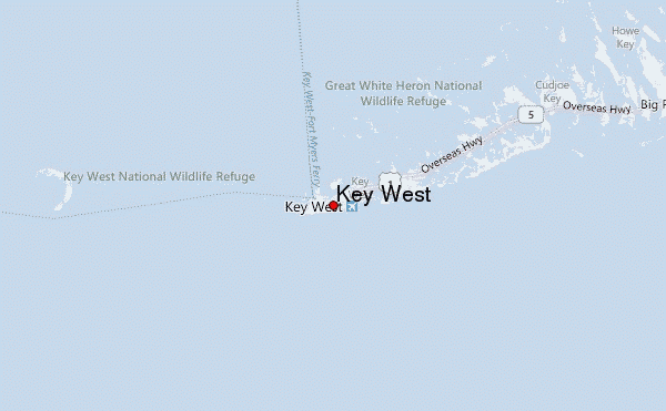
Key West lies at the western end of a 125 mile chain of keys or low
islands which extends southwestward from the southeastern tip of mainland
Florida. The Keys are linked by the Overseas Highway whose bridges and
causeways straddle the numerous gaps in the chain.
The average elevation of the Florida Keys is 5 feet above mean sea
level. Key West is mostly 6 to 8 feet in the east, rising in the west to a
plateau on the site of the old town of 12 to 18 feet.
The surrounding underwater topography is dominated by the shallow reef
extending to between 5 and 10 miles either side of the chain of keys. To
the south, the reef terminates abruptly where the ocean floor plunges to
form the northern boundary of the Straits of Florida. To the north, the
reef is both wider and shallower, and shelves only slowly towards the
shallow eastern waters of the Gulf of Mexico. Some shelter exists in the
shallow waters of the reef to the north of the main keys. This is provided
by a broken line of sand flats and mangrove-covered, uninhabited keys
which lie parallel to the main keys and approximately 4 miles to the
north.
Key West Weather & Climate
| AVERAGE KEY WEST TEMPERATURES |
|
Fahrenheit |
Celsius |
| MONTH |
HIGH |
LOW |
HIGH |
LOW |
| January |
75 |
65 |
24 |
18 |
| February |
76 |
66 |
24 |
19 |
| March |
79 |
69 |
26 |
21 |
| April |
82 |
72 |
28 |
22 |
| May |
85 |
76 |
29 |
24 |
| June |
88 |
79 |
31 |
26 |
| July |
89 |
80 |
32 |
27 |
| August |
90 |
79 |
32 |
26 |
| September |
88 |
79 |
31 |
26 |
| October |
85 |
76 |
29 |
24 |
| November |
81 |
72 |
27 |
22 |
| December |
77 |
67 |
25 |
19 |
| Temperature averages based on data collected at Key West Airport. |


The Physical Environment
The delicate chain of islands, or "keys", extending
from the southern tip of Florida is internationally
regarded as a tropical paradise. This perception can
mainly be attributed not to the islands themselves, but
to the clear, shallow waters surrounding them. These
warm tropical waters are also known today as the Florida
Keys National Marine Sanctuary (FKNMS). The Florida Keys
and its marine environment offer unparalleled beauty and
diversity. Teeming with thousands of colorful tropical
fish, marine invertebrates and plants, the waters of the
Florida Keys are home to the world's third largest
barrier coral reef system, thousands of acres of
seagrasses, and hundreds of miles of mangrove-fringed
shoreline. The waters surrounding the Florida Keys have
long been appreciated for their unique beauty and the
abundance of the marine life they support. That
world-renowned appreciation was echoed by Congress when,
in 1990, they designated these waters as a 2900
square-nautical-mile marine sanctuary.
The special beauty of the Florida Keys National Marine
Sanctuary brings with it some unique challenges for
protection. Every year, more than two and a half million
people come to the Keys to experience the wonders of the
waters. Year round, visitors and residents alike dive,
snorkel, fish, boat, and swim in these waters. A system of
mooring buoys, channel markers, and special marine zones is
in place to assure that the diverse and delicate ecosystem
of the Florida Keys National Marine Sanctuary remains
healthy for generations to come.
To protect the spectacular marine ecosystem of the
Florida Keys, the Florida Keys National Marine Sanctuary and
Protection Act was enacted by Congress and signed into law
by President Bush on November 16, 1990. The Act, first and
foremost, created the Florida Keys National Marine Sanctuary
boundaries, encompassing approximately 2900 square nautical
miles, with jurisdiction up to the mean high tide line. In
addition, the Act called for the National Oceanic and
Atmospheric Administration (NOAA) of the U.S. Department of
Commerce to prepare a comprehensive management plan for the
Sanctuary after consulting with the public and with federal,
state, and local government authorities. An Advisory Council
was established to act as conduit of public opinion and to
assist in the development of the plan. The FKNMS
Comprehensive Management Plan was developed and Sanctuary
regulations went into effect on July 1, 1997. The revised
Management Plan went into effect in December 2007. The
entire text of the Sanctuary regulations is printed in the
June 12, 1997 edition of the Federal Register. The
regulations for the more recently established Tortugas
Ecological Reserve are printed in the January 17, 2001
edition of the Federal register.
County:
Monroe
Nearby towns or cities: Florida Keys, Key West, Marathon, Key Largo
The FKNMS encompasses 3,801 square miles of
protected area consisting of the waters surrounding
the archipelago formed by the Florida Keys which
includes waters of Florida Bay, the Gulf of Mexico,
and the Atlantic Ocean.
The Florida Keys National Marine Sanctuary is at
the conflux of three watersheds. First, the
Mississippi River watershed drains 40% of the
continental United States. The Mississippi River
eventually drains down into the Gulf of Mexico where
those waters are then picked up by the Loop Current
which can be traced passing the Florida Keys as it
merges with the Florida Current (Gulf Stream).
Second, the Florida Bay and the Florida Keys are the
end recipients of the Kissimmee Okeechobee
Everglades (KOE) watershed which drains much of the
state of Florida. The third watershed affecting the
waters of the Keys originates in the Caribbean,
where the waters draining to the ocean are funneled
through the Yucatan straight and eventually merge
with the Florida Current (Gulf Stream).
Although the
best known feature of the Keys marine environment is its
coral
reefs, the shallow waters near the shore are actually composed of a
series of interconnecting and interdependent natural habitats.
These include fringing
mangroves and
seagrass meadows as well as
hardbottom regions, patch reefs and bank reefs.
When healthy, the communities of
mangroves, seagrasses and corals protect and enhance one another.
Upland, hardwood hammocks are equally important: they protect the
soil from erosion while their decaying vegetation provides
necessary nutrients to the mangrove and seagrass communities. In
turn, mangroves, seagrass beds and coral reefs serve as
self-repairing breakwaters to protect the hammocks--and the rest of
the Keys--by absorbing the force of the waves.
Fringing mangroves filter material
washed from the land, trapping debris and sediment. The remains of
plants and animals are broken down by bacteria and fungi, into
nutrients. Mangrove roots provide nursery grounds to to many
species of fish and invertebrates. Mangrove forests near North Key
Largo also are habitat for the endangered American crocodile.
Seagrass meadows grow in much of
Florida Bay and the shallow waters seaward out to the reef line.
They are a natural trap for sediments. The predominant turtle
grasses, which happen to be particularly vulnerable to pollution,
are nursery and feeding grounds for a host of attaching
invertebrates and for the larvae and young of many organisms. These
include shrimp, spiny lobster, sea urchins, sponges, snapper, sea
trout, barracuda and grunts. Adult fish from the reefs often feed
among the seagrasses, and endangered species of green sea turtles
and manatees browse there regularly.
The Florida reef tract is the most
extensive living coral reef system in North American waters and the
third largest reef system in the world. It provides habitat,
refuge, and feeding grounds for countless colorful and exotic
creatures. Colonies of tiny polyps from the complex structure of
coral reefs by secreting calcium carbonate. The waving forests of
sea whips and sea fans in the Keys are a uniquely Caribbean
feature, and are not found on reefs in the Pacific and Indian
Oceans.
The geological processes that formed the
reefs and the Florida Keys as we know them today
began in the Pleistocene Period. During this
era, melting glaciers following an ice age
raised sea level to where water covered much of
the Florida peninsula and all of the area that
is now the Keys. The warm temperatures and
shallow waters that covered this area were ideal
for coral growth. Scientists have found that the
Keys developed into a nearly continuous coral
reef tract from the area that is now Miami to
the Dry Tortugas. Core samples show massive hard
corals and point to a larger, denser coral reef
system than the living reef that now lies off
our shores. When the last ice age struck, about
28,000 years ago, sea levels dropped
drastically, and the Keys, as well as the
Florida Bay, were transformed into swamp, then
dry land. Then, about 11,000 years ago, water
levels moderated to about where they are now,
leaving the Keys exposed and filling Florida
Bay. From these ancient reef formations, two
types of substrate were formed: Miami Oolite,
and Key Largo Limestone. Both of these rock
types are the remnants of fossil coral
ecosystems, and both are extremely porous.
The Florida Keys National Marine Sanctuary’s
submerged cultural resources are unique,
non-renewable remnants of the Key’s colorful
maritime and submerged prehistoric past.
Submerged cultural resources are defined as
those "possessing historical, cultural,
archaeological, or paleontological
significance, including sites, structures,
districts, and objects significantly
associated with or representative of earlier
people, cultures, and human activities and
events" (15 CFR 922.2 (c)). The Sanctuary’s
submerged cultural resources encompass a
broad historical range from the European
Colonial Period to the Modern Era. Because
of the Keys’ strategic location on early
European shipping routes, the area’s
shipwrecks reflect the history of the entire
period of discovery and colonization. The
unique geological history of the Florida
Keys with its treacherous shallow and hidden
reef, set the stage for a colorful human
history. Shoals, sand flats, storms, and the
coral reef itself have stymied many
navigators through the centuries, and taken
their toll on many ships. Since the 1500's
over 800 documented shipwrecks have occurred
around the reefs and sand flats of the
Florida Keys. These vessels, which now rest
upon the ocean floor, carried a wide variety
of cargoes throughout the centuries, cargoes
that ranged from settlers, slaves, and
soldiers, to merchandise and treasure.
During the early twentieth century the
"wreckers" of the keys salvaged virtually
everything they could find, leaving behind
little original wrecks. These wrecks and the
stories that surround them give the Keys a
rich and exciting maritime culture. In
addition to the human aspect, these
shipwrecks, often referred to as "windows to
the past" also serve as artificial reefs,
providing an anchor and abode for the
brilliant and diverse life that inhabits
these waters.
The Key Largo and Looe Key National
Marine Sanctuaries were established in
1975 and 1981 respectively and were
incorporated into the new Florida Keys
National Marine Sanctuary Management
plan.
The State of Florida and the federal government have been
working together for over 34 years to protect the marine
environment in the Florida Keys. This effective partnership
continues today in the Florida Keys National Marine
Sanctuary. Such a combined effort provides a comprehensive
ecosystem management approach for the long-term protection
of diverse natural resources in Keys waters. The National
Oceanic and Atmospheric Administration (NOAA), part of the
U.S. Department of Commerce, is the federal agency that
oversees the National Marine Sanctuary program. The Florida
Department of Environmental Protection (FDEP) is the state
partner involved in FKNMS management. Together these
agencies cooperate and consult with each other on how to
ensure the protection of FKNMS resources.
The Florida Keys National Marine Sanctuary and Protection
Act lays out certain rules for the FKNMS:
- Oil and gas development are prohibited; and
- Commercial vessel traffic is restricted within an
internationally designated "Area to be Avoided."
The Act also places particular emphasis on improving the
water quality throughout the area. The US Environmental
Protection Agency and the Governor of Florida, in
consultation with NOAA, were directed to prepare a water
quality protection program which were included in the
comprehensive management plan.
The 14 Action Plans within the FKNMS Management Plan
include: Science Management and Administration, Waterway
Management, Education/Outreach, Enforcement, Mooring Buoys,
Regulatory, Research and Monitoring, Maritime Heritage
Resources, Damage Assessment and Restoration, Water Quality,
Operations, Evaluation, Volunteer and Marine Zoning.
Revised Management Plan- December 2007
(
http://floridakeys.noaa.gov/pdfs/2007_man_plan.pdf)
Strategy for Stewardship: Florida Keys
National Marine Sanctuary Final
Management Plan/Environmental Impact
Statement Volumes 1-3 (
http://floridakeys.noaa.gov/management/welcome.html)
Florida Keys Eco-Discovery Center in Key West, FL-
http://floridakeys.noaa.gov/eco_discovery.html
Various posters, maps and brochures can be
obtained by contacting the Sanctuary office.
Please see the FKNMS website forand further information:
http://floridakeys.noaa.gov